I've had Rockstar on my mind for a couple of years. It's the brainchild of some folks down in Virginia. I believe the original 'bad' idea was a 270 mile bikepacking route (mountain bike) from Harrisonburg to Roanoke Virginia. The first 'grand depart' was in 2018, with just a handful of crazy people at the start line. Since 2018, they've also developed a gravel route and a road route. I'm still not set up for bikepacking - never tried it, so I gravitated toward the gravel route, which, it seemed, might be completed in a day. The 'FKT' (fastest known time) for a solo rider was 24 hours and change, though Gordon Wadsworth and Eliott Baring had just cruised to a 20 hour finish as a team.
My family was headed to the Outer Banks for a week, the second week in June. Not being a beachy kinda guy, I decided this was my window of opportunity for a Rockstar attempt. The weather forecast did not cooperate, however. So I packed my car for every possible eventuality and headed to Hatteras, NC. The weather was pretty good down there, but the forecast in Virginia's mountains continued to be sketchy. Finally, at the end of the week, it looked like Sunday and Monday might offer a sliver of an opportunity. Temps in the mid 80's with possibility of afternoon thunderstorms. Not ideal, but I could work with that. I drove through a huge downpour, arriving in Harrisonburg. Things would be hot and steamy the next day.
Somehow, I convinced my friend Ben to run support for me (not sure he really knew what he was in for). Our previous adventures included beach trips to Vietnam and diving trips to the Philippines - in what seems like a different lifetime. Saturday, I headed for Harrisonburg, 6.5 hours from Hatteras. I booked a hotel a couple of blocks from the 'official' start of the ride - Black Sheep Coffee in Harrisonburg. I met with Ben to hash out the first couple of aid stops and was treated to a great meal at his friends' place. Back to the hotel, loaded my frame bag and feed bag and filled 4 bottles. In Bed by 10.
Alarm went off at 3:20. Was planning a 4AM start. Ben had asked me why and my answer was 'I have no idea.' Just seemed to be what other riders had done. The overnight desk clerk at the hotel was pretty confused to see me, with my bike, checking out at 4AM.
It took me a little while to find Black Sheep Coffee - the official start of the route. But I found it. Powered up my Spot GPS tracker and rolled out about 4:20. The initial miles out of Harrisonburg were pavement, some bike path, more pavement through farmland where hordes of cows were getting hooked up to milking machines. Route-finding in town was a little tricky. Made some wrong turns. The sun came up sooner than I expected and I powered off my light.
| milking barn at twilight |
Before too long, I found myself climbing. The climb up to Flagpole Knob was brutal. I knew it was big climb, but steep...so steep. And slick from the previous day's rain. Big chunky rocks. It was a 4x4 road. The 'Dry Run Rd Climb' Strava segment is 3.5 miles at an average 10% grade (1776ft) - and that's only a portion of the climb. It was slow going. There was walking involved.
  |
| switchback on the Dry Run Rd Climb |
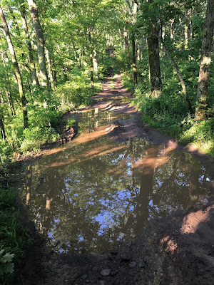
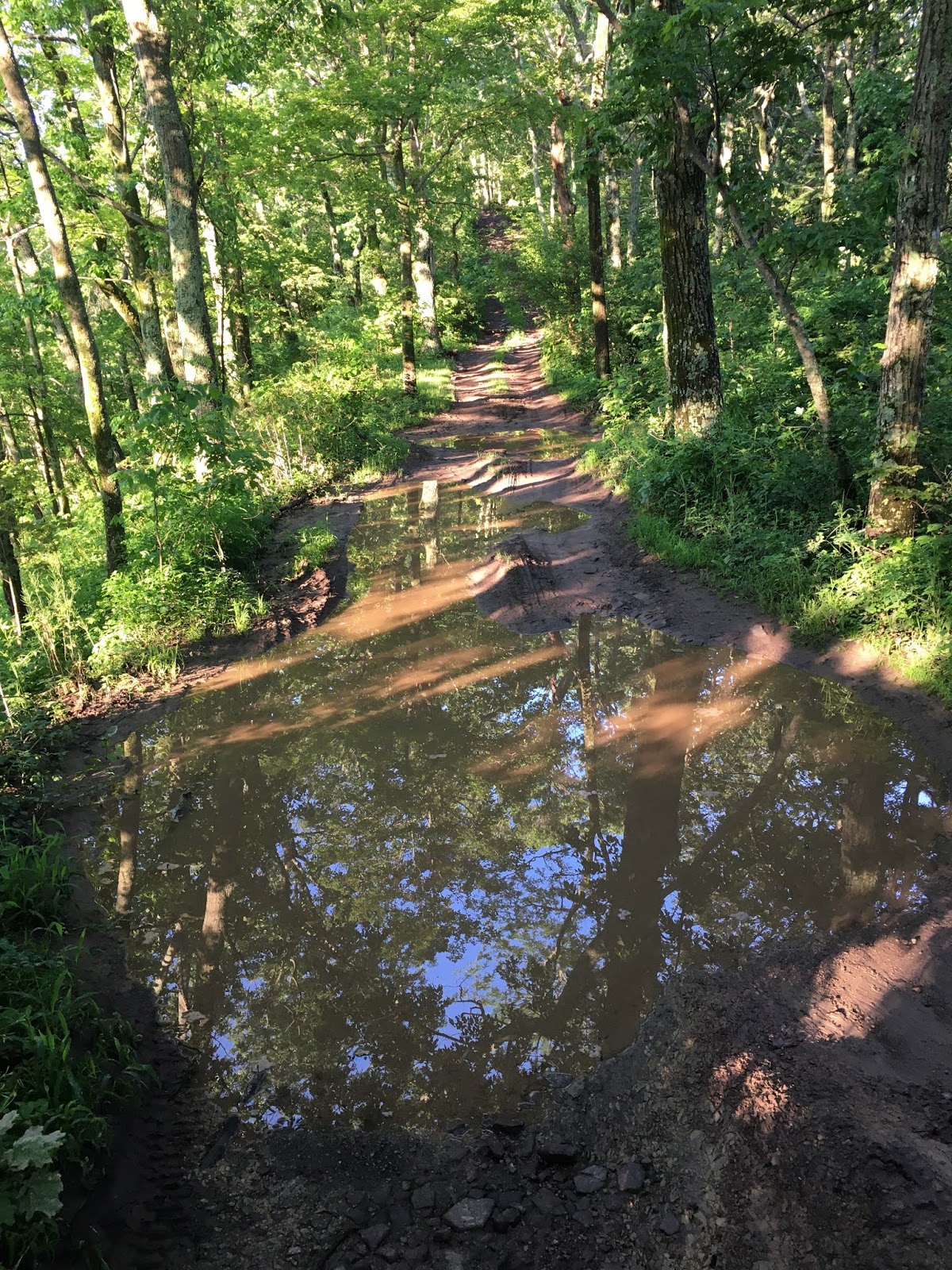
Some of the road up to Flagpole Knob reminded me of Hilly Billy Roubaix; lotsa mudholes, freshly filled. No idea how deep they were until I tried to ride them. After getting stuck in one up to the wheel axles, I became pretty tentative in approaching the others.


 |
| reminding me how slowly I was moving |

Reddish Knob is the high point on the route at about 4400 feet. It took me 4.5 hours to cover the 36 miles from Harrisonburg. All down hill from here? Not exactly.


From Reddish, I had about another 30 miles to cover before the first planned meetup with Ben. I don't have too many memories of this section. It was pretty quick and I was just thinking how late I was going to be to our first meetup. I stopped at the Mountain View General Store - used the toilet and bought a sub, mainly because I though I should buy something. It was a slow slog 1000 ft climb up paved 250 with a bit of traffic. On the way up 250, I got passed by fast mtb dude, John Petrylak wearing a race number. I asked him what race was going on - it was Stoopid 50, a race I had done last year. Had no idea it was happening this year, with all the COVID precautions. It was nearly 11am when I got to the overlook (the Confederate Breastworks ? Interpretive Site). No Ben. I ate the sub and bummed some water off of some nice Harley-driving gentlemen, hanging around for 15 minutes or so. Well - no Ben, so I decided to push the next 40 miles. I probably had enough to drink. Definitely had enough food. So I rode back down 250 and took a right on the gravel. There was Ben, hanging out at the Stoopid 50 aid station. I guess the map pin I gave him wasn't accurate. Since I'd already spent 15 minutes at the overlook, I wasn't keen on killing more time. So the list of things wanted to do - like lube my chain - was summarily dismissed. I hung around for a few minutes, filled my bottles and carried on. While I was there, the Stoopid 50 race leaders came through. I was a little jealous that they'd be done in an hour or two, and I still had 18 hours, or so, left.
The climb away from the aid station was brutally steep. Sustained 15% for a while. Soul-sucking. My gearing wasn't ideal, with a 40x36 as my lowest gear. But a hell of a lot better than my usual 40x20 singlespeed! I made way for a few racers bombing down the hill, but I was soon off of their course and back in solo sufferlandia. Near the high point, there was a singletrack connector that was a cool little stretch. Somebody had recently cut some trees off of this little-used trail. Thank you!

After the descent and a short stretch of pavement, I hit the 'Sugar Tree South' Strava segment. Sugar Tree Road is a gravel super-highway, so unlike anything else on this route. I'd been on poorly maintained (unmaintained) jeep and ATV trails, singletrack and pitchy, twisty forest roads (15%). This one was over-constructed by someone to take out all of the steep grades (max 7%) and have wide, sweeping turns instead of hairpins. If any of my Japan-based buddies are reading this, it's really similar to Tanba Rindo, but no pavement. 18 miles of fun. I was most impressed by the engineering of the road where it crossed streams. The streams were usually run through culverts that were 50 feet, or more, below the road surface to allow for the sweeping bends in the road. Still wondering 'why' it was constructed this way.

 |
| Pretty exposed = really hot |
I found Ben waiting around mile 105. I ate the Egg McMuffin that was to be my 2nd breakfast. Yum. I refilled bottles, changed my forever-drenched socks (this was a losing battle on the day), re-lubed vital areas, including my bike chain which had been screaming loudly since just after I stopped the last time. I had just over 40 miles to the next stop, so the halfway point would occur somewhere in this stretch. After 15 minutes of restocking and re-lubing, I was getting ready to get back on the bike when the first huge raindrops started to fall. Already moving slower than anticipated, I didn't really want to delay, but the storm had other ideas. The first big lightning bolt hit nearby and we took shelter in the car, for what ended up being about an hour.
Riding away from Ben, the world was soggy, but at least it was cooler. Already difficult conditions were a little more so. Soggy, mushy gravel made it seem like 50% more effort was required. But it was beautiful. This section included a nice stretch of gravel that bypassed Douthat State Park (great place to mountain bike and home to the infamous Middle Mountain Momma Race), though the rolling nature of the terrain got a little tiresome, having ridden 110++ miles already. The rollers were followed by a pair of substantial climbs (1000' and 700') up and over Middle Mountain.

 |
| freshly graded peanut butter |


From Middle Mountain, it was a cruise into Covington, VA, and then 7 miles of frontage road next to I-64 on the way to Love's Truckstop in Low Moor. Here I did a complete costume change, reapplied lube in all the necessary spots and bought a footlong sub from Subway. I ate 2/3 and saved the rest for the 'last' resupply spot. I had a coke and some chips - the sugar and salt hit the spot. I grabbed my lights and extra batteries, just in case and pushed on. I make this sound like a quick stop, but in reality it was almost an hour. Moving too slowly...and happy to be off the bike for a while
From Low Moor, I had about 45 miles to the last resupply point at mile 190. That would put me about 65 miles from Roanoke and I figured I could ride through the night and carry enough food and gear to survive those dark hours.
The first 15 miles out of Low Moor were paved and included a 900 foot climb and similar descent and some flat pedaling along Craig Creek. It got dark soon after I left Low Moor. I was still feeling OK, given the punishment sustained, so far.


Remember this road from exploring the area during my time at VT. Still baffling.
The next 30 miles had some sustained climbing, but low-grade stuff. Not too taxing, until the climb up to Ben at the final aid stop - another 900 foot, 6% push. 190 miles down. Roughly 65 to go. I was feeling a little loopy at 12:30, having woken up at 3:20AM - working on 4 hours of sleep or so. I ate the rest of my sub, had a coke and made a futile change of socks. More lube. Ben filled some bottles for me and I was out of there just before 1AM, thinking a 7AM finish would be about right.
Ben and I chatted for a bit about which direction he should head out of the woods. He could follow me on the route, or head back the way he came. Good thing he turned around, or he might still be out in those woods. He headed to Roanoke and his well-deserved bed.
The next 12 miles took an hour and a half. The afternoon rain had made all of the stream crossings pretty exciting. And deep. My dry socks were dry for about 10 minutes, I think. The road was slick from the rain and it was stop/start and up/down the whole way to Rte 311. On 311, the major route from these mountains to Roanoke, I passed old haunts - the Dragon's Tooth trailhead and Catawba Grocery. Even made a lap around the parking lot of Catawba grocery - not sure why - feeling nostalgic? Rolled past 624 to Newport and Blacksburg Rd. Lots of time spent on those roads - but not on a bike, haha! Rolled by The Homeplace restaurant; memories of stuffing myself and feeling sick on the ride back to Blacksburg. Continuing on toward Roanoke on 311, I saw perhaps the strangest thing in all of the dark hours. I came upon a cop car with lights on on the shoulder of 311 at the McAfee's Knob (AT) parking. But when I passed it, I realized that there were 15 or 20 police cars in the lot. Some kind of shift change? Not sure what was going on, but there were groups of police standing around talking - at roughly 3AM.
If you've enjoyed all of the sunshine and positivity to this point, you might want to stop reading, because shit's about to get real. :)
The last 50 miles of the course were mentally brutal. 210+ miles in, I just wanted to be finished.
At this point, began the most ridiculously circuitous tour of all of the cycling attractions Roanoke has to offer - starting with Carvin's Cove. I've ridden Carvin's Cove before - raced the Creature a couple of years ago. I loved it. It's gonna take a while to get over this most recent experience. Six miles of paved rollers led to the "Happy Valley Trail," a rutted, rough, slimy-from-rain slog that didn't, at all, fit the name. Had to get off the bike innumerable times. But it got worse. The Happy Valley Trail connected to a singletrack connector trail to get away from Carvin's. It was overgrown and nearly impossible to ride. All of the vegetation hanging over the trail was sopping wet from the rain. It took about an hour and fifteen minutes to navigate less than 7 mile around Carvin's Cove, with almost no climbing. It almost broke me, mentally.

From Carvin's, the course led in a distinctly indirect way to the Roanoke River Greenway. The Greenway was made more exciting by massive flooding the day before. Debris and deep sand was encountered frequently. Felt kinda like cyclocross for a while. I think I was falling asleep on the bike at this point. After 5 or 6 miles of CX, I made my way to the base of Mill Mountain. There was a bonus singletrack hike-a-bike section for a little while. I totally gave up trying to ride it, complete exhaustion setting in. It was about a half mile, but felt like 20 miles. The trail popped out on the road that led to the top - a 400 foot, 6% climb that might as well have been Mount Everest.
 |
| Somewhere in Roanoke (?), crossing the river |
 |
| Roanoke is a cycling town |
 |
| Mill Mountain Viewpoint |
 |
| Texas Tavern - open 24 hours |
I topped out on Mill Mountain a little after 7:30AM. Knowing that all the work was done, I actually enjoyed the last couple of miles to the Texas Tavern - the 24-hour greasy-food-slinging establishment that is the official endpoint of the route. The route down was a closed, paved road with impressive switchbacks. Felt kinda like Japan, again. I ate a cheezeburger and a sausage egg and cheese sandwich, had yet another coke and headed to the hotel for a 4 hour death-like nap.
Epilogue:
I'd been wanting to do a huge ride like this for a while. Maybe since last year's 200 mile gravel adventure, the Dirty Double-cross, up in north central PA. The amount of climbing in this route is a little bit nuts and I totally underestimated the difficulty of some sections of this route - in terms of grade and surface. My ride time wasn't too far off what I predicted, but I feel like I was stationary for too long (5+ hours). I went into it thinking...maybe... I could match the fastest known time of 24 hours, 3 minutes. I probably could have, with better planning and slightly better conditions.
My planning for this ride was pretty half-assed. Didn't think real hard about food. Probably didn't eat enough (2 subs, 2 bananas, a bag of chips and an egg mcmuffin, plus maybe 8 gels, a couple of stroop waffles and a package of shot blocks - oh and 4 cans of soda). I was definitely dehydrated at the end. I think I only drank maybe 2 1/2 bottles the last 7 hours. Not the best strategy...
Well, there is always next time. Who wants to keep me company? Already thinking about the next one...


No comments:
Post a Comment